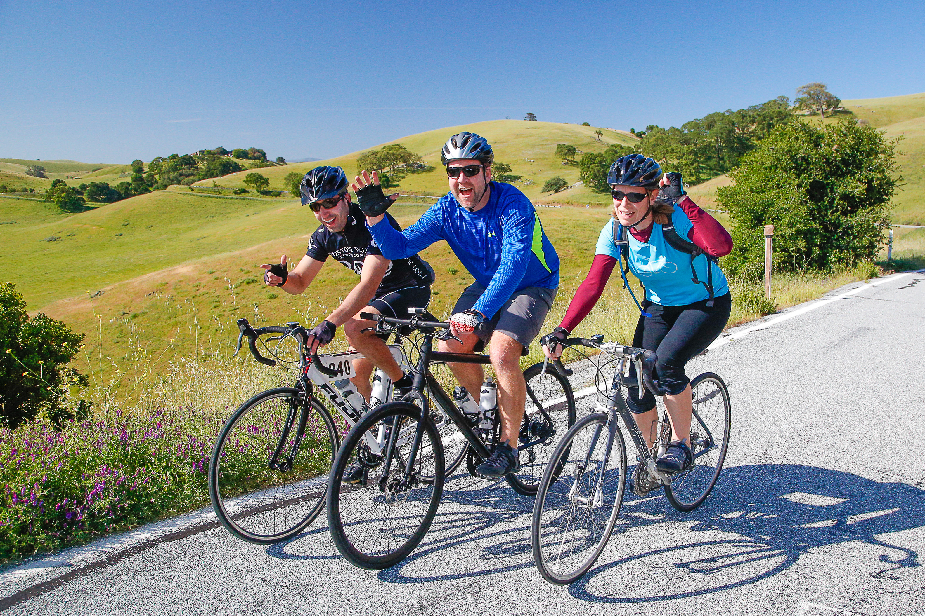
100 mile and 100k Route (25 mile Fun ride at bottom)
We’v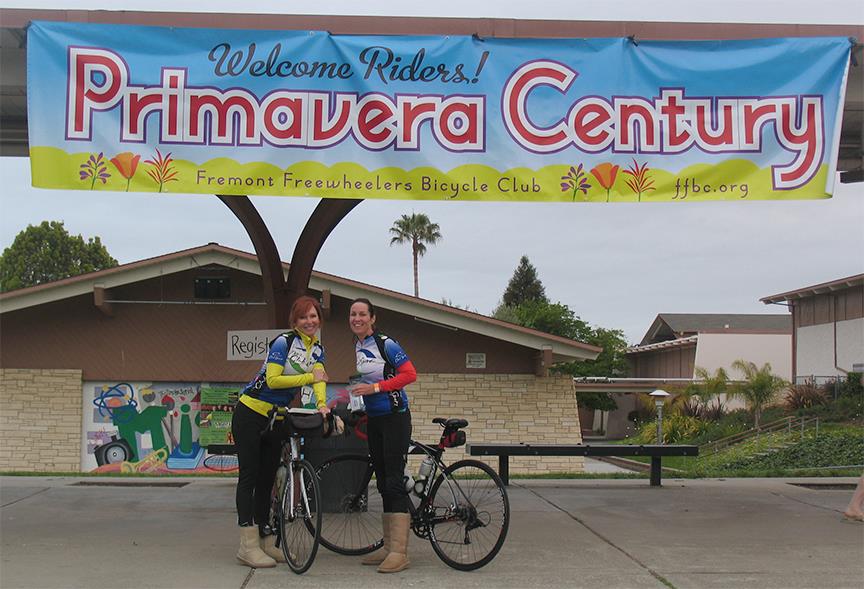 e again modified the route we’ve used in recent years to avoid construction in Niles Canyon. Instead of fighting the wind in Dublin Canyon and suffering that last mile up Palomares Canyon, the routes will return to the starting point by going south along Calaveras Reservoir and back through Fremont to the start/finish. The last hill everyone complained about has been eliminated this year.
The ride starts from Mission San Jose High School and proceeds through the Mission San Jose and Warm Springs Districts of Fremont. Fremont was incorporated in 1956 from the towns of Niles, Mission San Jose, Irvington, Centerville, and Warm Springs.
When you leave the school, you’ll turn right onto Palm Avenue and past the former site of 4 Winds Nursery, home to true dwarf citrus. This year, you will ride to the end of Palm, make a right turn then a quick left onto Paseo Padre Parkway. You will be treated to views of the green hills and the bay. It has rollers, with more downs than ups. There are two relatively steep downhills, so be careful. After the second fast downhill, you will proceed through a signal and left onto Warm Springs Blvd.
Warm Springs Blvd is about a 1% downhill that’s nice and straight. This is when you want to be in a pace-line for a few miles of easy pedaling. Then it’s left on Scott Creek Road and a gentle to moderate uphill. Under the freeway, then right on Park Victoria for a few more feet of uphill and another gentle downhill for some more pace-lin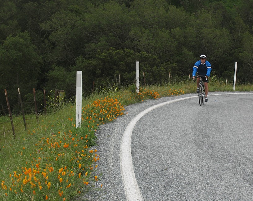 e work.
As the road starts downhill, there’s a park on the left (Jose Higuera Adobe Park) with bathrooms for those who can’t wait another 4 miles. After some rollers, it’s left on Evans for more rollers, then left onto Calaveras Road for the first major climb of the ride. It’s 3 miles and 1000 feet of climbing to the top of “the Wall”. The Wall is a short section with a 17% grade. The Tour of California has gone both up and down the Wall as the route has varied over the years. Just remember, as you’re working your lowest gear or pushing your bike: the pros went up at 16 to 18 miles an hour.
But before tackling the Wall, take a break with most of the climb behind you at the first rest stop at Spring Valley Volunteer Fire Department. Breakfast breads and cookies are always favorites at this rest stop. Many people start off the ride with only one full water bottle so they don’t hav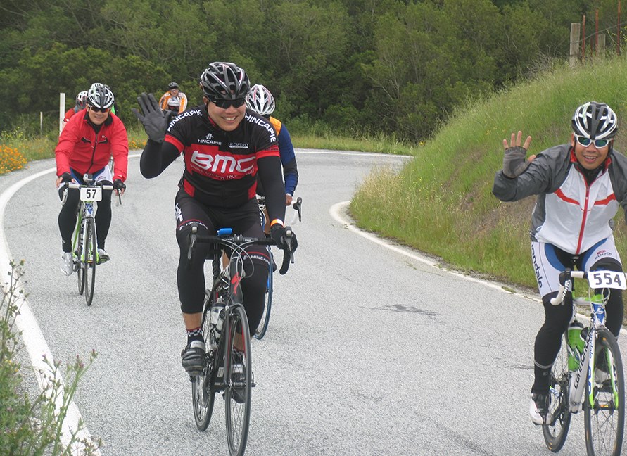 e to carry extra weight up Calaveras Road. We have bags to drop off clothes at the first three rest stops. Just put those extra layers in a bag with your name, rider number and cell phone number on it.
Soon you’ll make a left at the base of The Wall. From there, you’ll follow Calaveras Road as it winds its way around Calaveras Reservoir. In addition to sweeping views of the lake and dam, there is plentiful wildlife. You may see bald eagles, red tailed hawks and golden eagles roaming the skies. The reservoir was the largest earth filled dam in the world when it was constructed in 1925 as a water supply for the San Francisco. The dam was recently replaced for seismic safety. The Calaveras Fault is nearby. It was a major undertaking. It’s worth a picture or two.
After leaving sight of the reservoir, you approach a summit. Then there’s a long fun downhill followed by some very gentle rollers. This is another good section for pacelines and enjoying the views. Many nurseries are located along the valley along with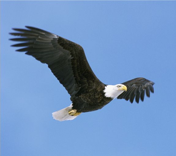 a couple of aggregate plants that produce gravel. Then it’s under the freeway and into Sunol.
There’s one more sight before turning into Sunol. At the stop sign, look to the left and see the Sunol Water Temple. This 1910 temple, at a mixing point of three water sources, and its twin temple at Crystal Springs Reservoir are the symbol of the Hetch Het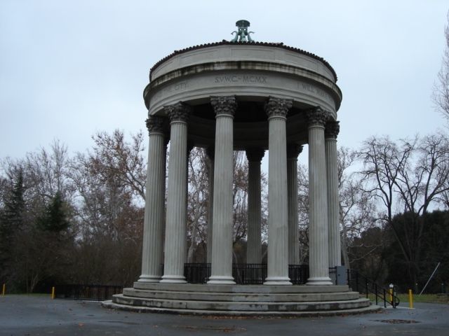 chy Water system, which was built by the City of San Francisco. The temple is modeled after the ancient Temple of Vesta in Tivoli, Italy (Tivoli is where many of the waters that feed Rome converged in the foothills of the Apennines). Unfortunately, the grounds and Temple are only open weekdays 9 to 3. The stop sign (soon to be stop light) is Scott Corner and a favorite for cyclists, but go another ¼ mile to a right turn into Sunol School.
Sunol School is site of the second rest stop. This rest stop crew always does a theme with costumes and music. No one knows what it will be this year, or at least they are not letting anyone know. This year, Bosco Bones and Brew will be providing baked potatoes and homemade cookies. food. Bosco’s is named for the dog who was elected mayor of Sunol.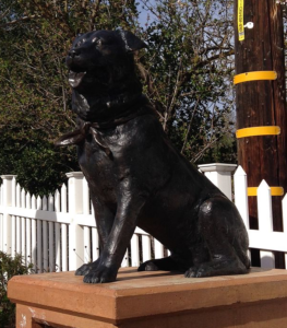
There’s a statue of Bosco (Bosco the Dog) on the right as you exit the rest stop onto Main Street, just past the post office. The bike friendly restraint is on the left. The route turns right just before the train station.
Niles Canyon Railway, which traces its history back to the first transcontinental railroad in 1866, runs vintage trains from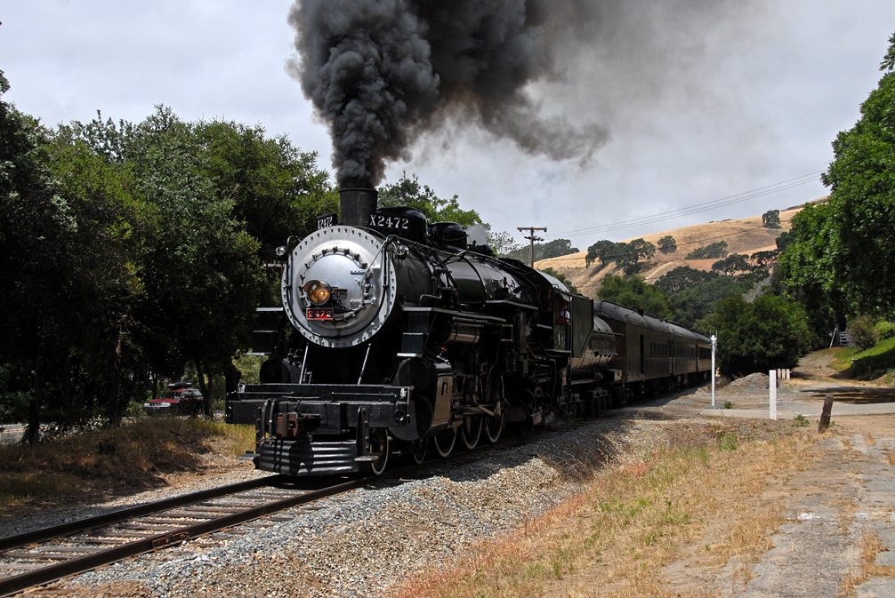 Niles to Sunol and back on many Sundays – possibly on the day of the Primavera.
So it’s two quick turns onto the lovely Foothill Road. If you don’t turn right just after the tracks, you’ll go up a dead end road for 5 miles! After a couple of rollers, watch out for some bad pavement.
Watch for signs to slow down for the turn on Foothill directing cyclists across Verona Bridge, an old iron bridge that once carried 50 guests a weekend to Phoebe Hearst’s Hacienda del Pozzo de Verona (mother of William Randolph Hearst), which is now a popular spot for bicyclists, nature lovers and pedestrians.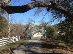
At the end of the bridge the 100k (63 mile) and 100 mile routes diverge. 100k riders turn right, and 100 mile riders turn left. The two routes come back together at the same spot, so 100k riders can skip a few paragraphs. For those who want to do 90 miles, go to the left then skip the Patterson Pass loop, described later. That saves 10 miles and a thousand feet of climbing, while still offering pleasant cycling through vineyards, nice views of Mt Diablo and a hearty lunch at Rios-Lovell Estate Winery.
After turning left onto Pleasanton Sunol Rd, take a right onto Happy Valley to wind through the oaks on a quiet lane before connecting with Sunol Blvd. Then it’s a short distance to a right turn on Kottinger, past a park to Bernal Avenue and right onto Vineyard Drive for more smooth roads into Livermore. Note that this is a change from prior years. The first commercial vineyards and winery in Alameda County were established in the 1850’s by J. W. Kottinger in Pleasanton. His barn is the oldest building in Pleasanton.
The route travels through vineyards south and west of the town of Livermore. There are several roads with bike/hike trails parallel to them. Feel free to ride them. SAG drivers will keep an eye out for breakdowns on the trails, but you need to be where they can get to you for that spare tube, to use a floor pump or to get a ride to the next rest stop. All rest stops have professional mechanics.
Just before the rest stop at Rios-Lovell Estate Winery, there’s a stop light at Vasco Road. For those wanting to do the 90 mile option, continue straight a hundred yards or so and turn left into the winery. Be very careful turning left as cars do not stop and the speed limit is 45.
For the full 100 mile experience, you turn left on Vasco Road and ride past Lawrence Livermore Laboratory. Element 116, discovered in 2000, is named Livermorium in honor of the lab. Then turn right on Patterson Pass Road, right on Cross Road, then right on Tesla Road to the rest stop at Rios-Lovell Estate Winery. The winery has a wonderful view and good shade. You may want to come back another time to try their wines, especially the port.
After a rest and needed nourishment, it’s east on Tesla and left on Concannon, then a few turns to Vineyard and back through Pleasanton. Sunol Boulevard turns into Sunol-Pleasanton Road, which takes you back to the Verona Bridge.
(100k riders, start paying attention again)
The route then follows Sunol-Peasant Road towards the Hetch Hetchy Water Temple. There are two railroad crossings that cross the road diagonally, so be careful! The tracks are easier to cross in the bike lane than in the roadway.
Past the Cal Fire Station, at Scott Corner, take a left onto Paloma Way after a quick peek at the Water Temple. Paloma Way becomes Calaveras Road when it passes under the freeway. If the light at Niles Canyon and Main Street in Sunol is ever turned on, we will extend the hours of the Sunol School Rest Stop and provide water, Gu Brew, and restrooms. If that is the case, there will be no water stop at the false summit this year.
So its back on Calaveras Road for views of the reservoir from a different perspective. Please be extra careful on the downhill at “the Wall” and beyond. Cars don’t stop at the intersection at the base of “the Wall”, so make a good stop and look.
The last rest stop before the finish is at Spring Valley Volunteer Fire Department. Take a quick break and have an ice cream or Popsicle to enjoy the last of the ride back. After the rest stop, be extra careful of bad pavement. There are some bad sections of road, so use your brakes and be careful.
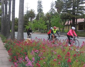
Once in Fremont, the route goes back to the school along Mission Boulevard. After turning right onto Mission Blvd, the next road is Stanford Avenue, where Leland Stanford had vineyards and a winery. Then it is three miles, or so, to Mission San Jose. Ohlone College, named for the original residents, the Ohlone Indians, is on the right. The olive trees that you see on your right were planted by the missionaries over 200 years ago.
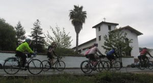
You will turn left just before Mission San Jose, which was founded in 1797. It is the fourteenth of the 21 Spanish Missions in Alta California. The mission church was destroyed in the earthquake of 1868 and was rebuilt in the last century. At the height of the mission, there were over 100 buildings with 12,000 cattle and an equal number of horses and sheep. It was considered the most prosperous mission in Northern California. The building just where you turn left is original and is the oldest building in Alameda County. It might be worth a 100-foot detour to get a picture in front of the church. It is only a mile to go to the finish. You turn left for a quick ride down Washington Blvd to Palm Avenue and the High School. Be careful as the city has put a concrete island in the bike lane!
A nice warm meal awaits the victorious riders. Please check in to get your meal ticket and lots of goodies.
25 mile Fun route
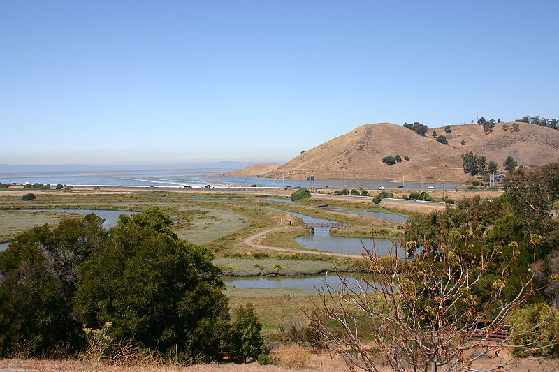
The 25 mile Fun Ride goes north on Paseo Padre Parkway from Palm Avenue via Olive Avenue. It follows Paseo Padre through Fremont, past the Central Park to Coyote Hills Regional Park and a rest stop. The route continues past the Visitor’s Center to Alameda Creek. Then the riders get an option to cycle all the way to the edge of the bay for a view of San Francisco and lots of wildlife. It’s 2 miles there and 2 miles back but it’s all flat and there is often a good view of San Francisco. Then the route goes along the Alameda Creek Trail bike path to a second well stocked rest stop. The route continues to the end of the trail at the mouth of Niles Canyon.
Niles, one of the towns that incorporated to form Fremont was the site of Valleo’s flour mill, then a train hub on the Transcontinental Railroad. It was also a site for early films, including those by Charlie Chapman and Bronco Billy.
A restroom and a water stop await the riders there. From there, the route winds through some quiet neighborhoods and takes a left turn onto Mission Blvd to return to the high school and a delicious hot meal.
![]()